Map Unit State Standards:
|
|
|
States and Capitals
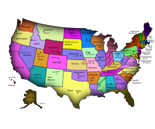
Montgomery Alabama Juneau Alaska Phoenix Arizona Little Rock Arkansas Sacramento California Denver Colorado Hartford Connecticut Dover Delaware Tallahassee Florida Atlanta Georgia Honolulu Hawaii Boise Idaho Springfield Illinois Indianapolis Indiana Des Moines Iowa Topeka Kansas Frankfort Kentucky Baton Rouge Louisiana Augusta Maine Annapolis Maryland Boston Massachusetts Lansing Michigan Saint Paul Minnesota Jackson Mississippi Jefferson City Missouri Helena Montana Lincoln Nebraska Carson City Nevada Concord New Hampshire Trenton New Jersey Santa Fe New Mexico Albany New York Raleigh North Carolina Bismarck North Dakota Columbus Ohio Oklahoma City Oklahoma Salem Oregon Harrisburg Pennsylvania Providence Rhode Island Columbia South Carolina Pierre South Dakota Nashville Tennessee Austin Texas Salt Lake City Utah Montpelier Vermont Richmond Virginia Olympia Washington Charleston West Virginia Madison Wisconsin Cheyenne Wyoming |
United States postal abbreviations for states, military, commonwealths, and territories.
US State: Abbreviation: Alabama AL Alaska AK Arizona AZ Arkansas AR California CA Colorado CO Connecticut CT Delaware DE Florida FL Georgia GA Hawaii HI Idaho ID Illinois IL Indiana IN Iowa IA Kansas KS Kentucky KY Louisiana LA Maine ME Maryland MD Massachusetts MA Michigan MI Minnesota MN Mississippi MS Missouri MO Montana MT Nebraska NE Nevada NV New Hampshire NH New Jersey NJ New Mexico NM New York NY North Carolina NC North Dakota ND Ohio OH Oklahoma OK Oregon OR Pennsylvania PA Rhode Island RI South Carolina SC South Dakota SD Tennessee TN Texas TX Utah UT Vermont VT Virginia VA Washington WA West Virginia WV Wisconsin WI Wyoming WY |
STARTER:
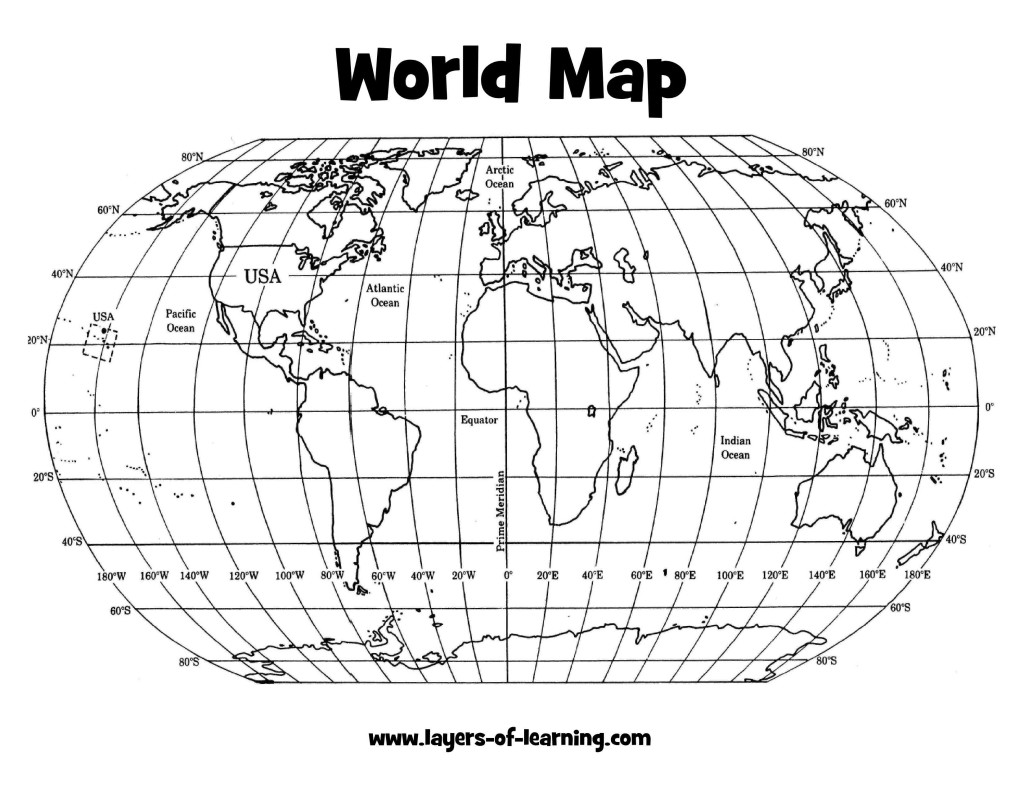
Finish your U.S. map with key. Add the state capitals for each state to the map. Look at the map above there are 3 mistakes on the map! See if you can find them!
Class work assignment:
Determine absolute and relative location of a specific place.
Using the Latitude and Longitude skills that you learned last week, write the name of the city and state found at the following latitude and longitude coordinates.
1. 33*N latitude, 112* W longitude
2. 35*N latitude, 78* W longitude
3. 46*N latitude, 96* W longitude
4. 45*N latitude, 122* W longitude
5. 29*N latitude, 95* W longitude
6. 43*N latitude, 79* W longitude
7. 25*N latitude, 80* W longitude
Starter:
Color and label the Continents! Use your book you have 10 minutes to finish. Shade or trace the outer edge of each Continent in a different color! Circle the name of each ocean in BLUE!
Color and label the Continents! Use your book you have 10 minutes to finish. Shade or trace the outer edge of each Continent in a different color! Circle the name of each ocean in BLUE!
Map Unit Assessment:
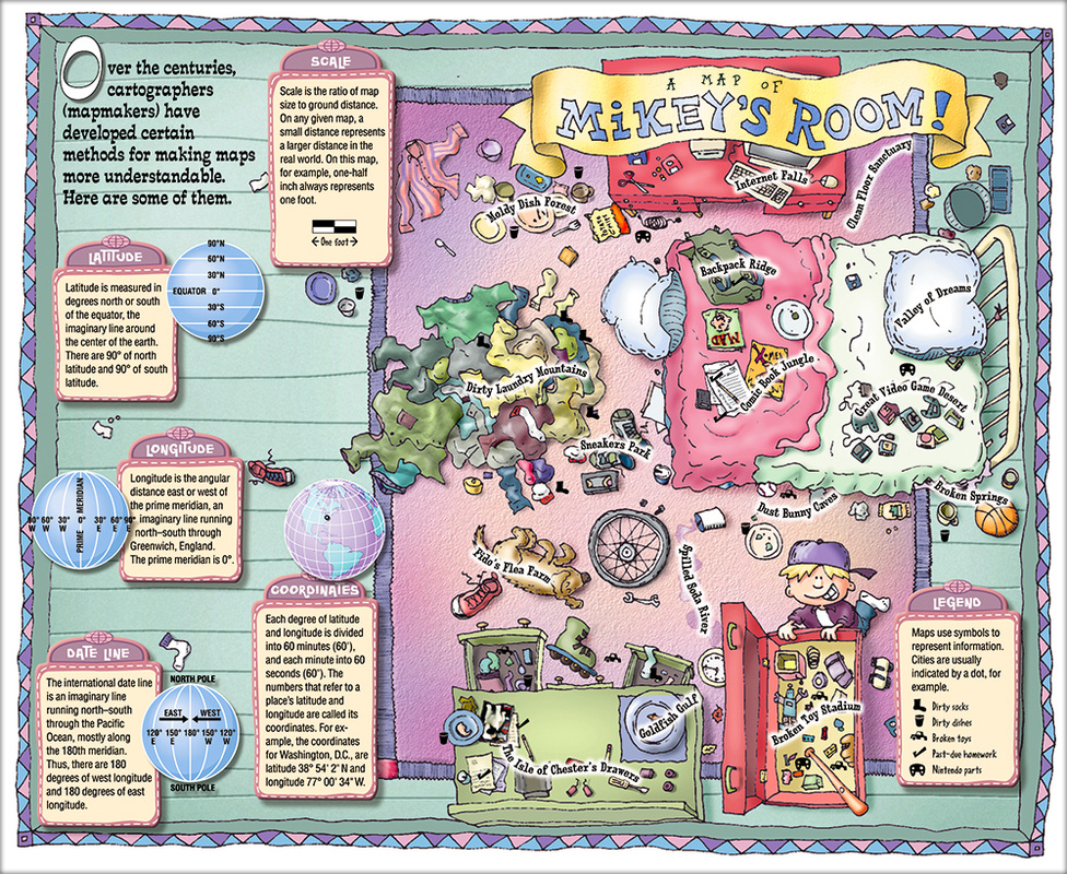
Design a map of your room be sure to include all the features we have learned about on your map: Scale, Legend/key, Title, Compass Rose. Due on Wednesday!

The Favorite Tool of the Historian.... The Calendar!

|
|
